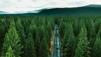
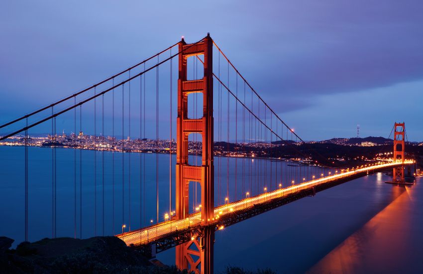
A sense of freedom comes with the open road—a thrilling adventure that beckons us to leave our worries behind and embark on a journey of discovery. And what better way to experience the sheer vastness and diversity of the United States than by undertaking a road trip from coast to coast?
Spanning approximately 2,800 miles on average of various routes from sea to shining sea, a road trip across the United States provides an unparalleled chance to witness the country’s diverse tapestry unfold before your eyes.
Whether you’re a seasoned traveler seeking new horizons or an intrepid adventurer ready to chart unfamiliar territory, the road trip distance coast to coast USA promises an unforgettable experience for your inner nomad.
We’ll delve into the marvels that await those who embark on this epic journey. So fasten your seatbelt, roll down the windows, and get ready to traverse the great expanse of the United States of America— a land of boundless beauty, untold stories, and unforgettable memories waiting to be made.
What is the Distance from Coast to Coast in the USA?
It will depend on which coast-to-coast points you depart from and want to end up in. It ranges from 2,800 miles to 3100+ miles. Here’s a table to help you quickly understand the stats:
| Destination | Route | Distance (miles/km) | Hours | Alternative Routes(miles/km) |
| Boston to Seattle | I- (The Northern Route) | 3045 miles/ 4900 km | 45h | I-94 (3045 miles/4900 km) |
| San Fran to Teaneck | I-80 (The Middle-America Route) | 2904 miles/ 4674 km | 43h | US-36 (2988 miles/4809 km) I-90 (3,100 miles/4989 km) |
| Barstow to North Carolina | I-40 (The Panhandle Crossing) | 2411 miles/ 3880 km | 35h | I-85 (2446 miles/ 3936 km) I-44/I-40 (2443 miles/ 3832 km) |
| West Sacramento to Ocean City | US-50 (The Loneliest Road in America) | 3113 miles/ 5010 km | 52h | I–94/I-90 (3045 miles/4900 km) |
| Santa Monica to Jacksonville | I-10 (The Southern Route) | 2430 miles/ 3911 km | 36h |
You’ll Also Like
Do you need a Passport for Tijuana?
Places to See in Barcelona in 2 days
Things to do at Niagara falls NY for Couples
What is the Easternmost Point In USA?
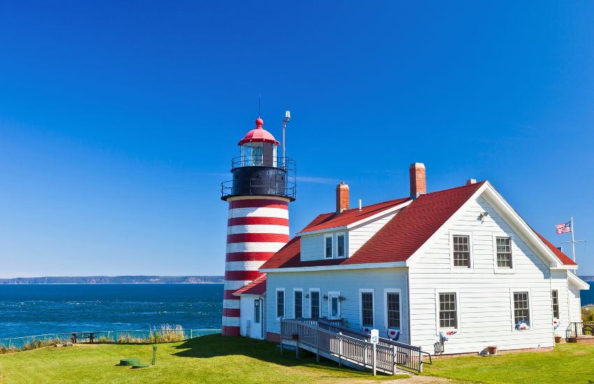
West Quoddy Head Lighthouse in Lubec, Maine, is the country’s easternmost part at exactly 44.8151° N, 66.9504° W. It’s also the home to one of the only two historic red and white painted lighthouses in America after its establishment in 1808.
What is the Westernmost Point In USA?
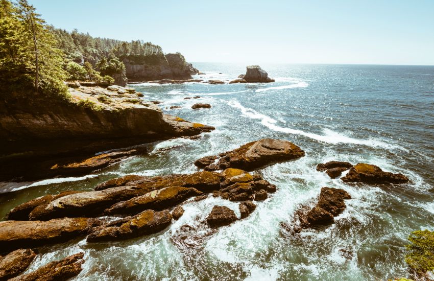
Cape Alava in Washington is USA’s westernmost point sitting at 48.1659° N, 124.7325° W. It’s located on the grounds of Makah Indian Reservation and Olympic National Park.
You’ll Also Like
Things to do in Nashville for Couples
Best Weather in Europe in November and December
Is Baja in the US or Mexico?
Longest Distance From East Coast To West Coast USA
The longest route you can take is following the US-50 from West Sacramento to Ocean City, with a distance of 3113 miles/ 5010 km requiring 52 hours of nonstop drive to complete.
Shortest Distance From East Coast To West Coast USA
You can follow the I-40 route, which only needs 35 hours to cover 2411 miles/ 3880 km from Barstow, California, to North Carolina.
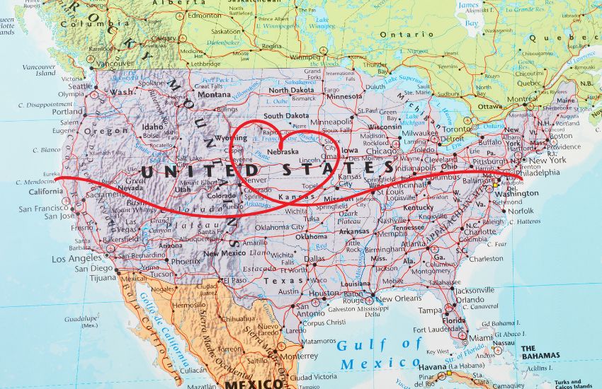
Routes for Driving Coast to Coast in USA
The Northern Route

The Northern Route cruises from Boston to Seattle through Interstate 90. The distance coast to coast USA via I-90 is roughly 3045 miles/ 4900 km. Some states it crosses include New York, Pennsylvania, Ohio, Indiana, Illinois, Wisconsin, Minnesota, and North Dakota, Montana.
You must drive nonstop for around 45 hours (with no traffic) to reach your destination. If you can drive for 9 hours/ day, it will take only five days. But, of course, if you go gently behind the wheel for 6 hours/day, you need 7.5 days. There’s also an alternative route that detours to I-94 with the same distance coast to coast USA.

Now, if you want to cover coast to coast literally, from water to water, you can clock in another 353 miles/568 km from east coast Boston and an additional 135/217 miles east coast of Seattle for a total of 3533 miles/5686 km.
There are plenty of attractions and activities you can try along the way. We listed some to help you craft your own itinerary:
- Six Flags New England
- World’s Smallest Church
- Jell-O Gallery Museum
- Eternal Flame
- Birthplace of Superman
- Olde Avon Village
- Pokagon State Park
- Washington Park Beach
- The Second City
- Legoland Discovery Center
- Goebbert’s Pumpkin Patch
- Lake Kegonsa State Park
- Pink Elephant
- Circus World Museum
- Witches Gulch
- Mill Bluff State Park
- FAST Fiberglass Mold Graveyard
- The Pearl Ice Cream Parlor & Confectionery
- SPAM® Museum
- Jolly Green Giant Statue
- Devil’s Gulch Park
- 1880 Cowboy Town
- Corn Palace
- State Historical Society/Cultural Heritage Center
- Minuteman Missile National Historic Site
- Art Alley
- Chapel in the Hills
- Mount Rushmore
- Tatanka: Story of the Bison
- Custer’s Last Stand: Little Big Horn
- Crazy Mountain Museum
- Our Lady Of The Rockies
- Old Prison Museum
- Oasis Bordello Museum
- Crystal Gold Mine
- Old Mission State Park
- John Wayne Pioneer Trail
- Snoqualmie Falls
We recommend that you take the Northern Route during shoulder seasons. Most of the drive will take you through mountain ranges, so it’s one of the best coast-to-coast journeys you’ll ever have if you’re all about nature.
You’ll Also Like
Most Romantic Places in French Riviera
How Do You Get to North Captiva Island Florida?
Can You Drink or Smoke on The Beach in Hawaii?
Differences between Niagara Falls and Horseshoe Falls
The Middle-America Route
Take your road trip through the sights along Interstate 80, from San Francisco in California to Teaneck in New Jersey. It spans 2904 miles/4674 km distance coast to coast USA and will require 43 hours of driving nonstop to complete with no traffic. That’s a day and 19 hours! Before you get to NJ, this trip will take you through Nevada, Utah, Wyoming, Nebraska, Iowa, Indiana, Ohio, and Pennsylvania.
Another route detours a bit through US-36, making it 2988 miles/4809 km, needing an extra hour to complete. The alternative that takes some sections of I-90 is even longer, with 3,100 miles/4989 km needing 45 hours to complete.
Traveling through I-80 is lengthy, so take your time. Plan your itinerary accordingly, and double-check with weather updates for your safety. Here are some stops you might want to consider for your adventure.
- Downtown Sacramento
- Empire Mine State Historic Park
- The Reno Arch
- Thunder Mountain Monument
- Western Folklife Center
- Rainbow Hotel Casino
- Salt Lake City, Utah, United States
- Bear River State Park
- Fort Bridger Historical Association
- Natural Corrals Archeological Site (Ice Caves)
- Fort Fred Steele Historic Site
- Wyoming Territorial Prison Museum
- ICBM Missile Museum
- Ash Hollow State Historical Site
- Union Pacific Railroad’s Bailey Yard
- Heartland Military Museum
- Classic Car Collection
- World’s Largest Time Capsule
- Omaha, Nebraska, United States
- Monument to the First Train Robbery in the West
- Des Moines, Iowa, United States
- Lagomarcino’s Confectionery
- Starved Rock State Park
- Michael Jackson’s House
- RV & Motorhome Hall of Fame
- Marblehead Lighthouse
- Cuyahoga Valley National Park
- McConnells Mill State Park
- Centralia (Ghost Town)
- Paterson Great Falls National Park
It is an incredibly long-distance coast-to-coast USA road trip. There are plenty of heavily-populated stops along the way, so you shouldn’t have any troubles even if you book your stay on a last-minute basis. Packaging plenty of snacks and drinks is also best to save some bucks. The Middle-America Route is a journey you can take any time of the year.
You’ll Also Like
Differences between Niagara Falls and Horseshoe Falls
Best Nightlife in Europe in December
Most Kid-Friendly Countries to Visit
Best European Cities to Visit in December
The Panhandle Crossing
The Panhandle Crossing traces Interstate 40 from Barstow in Cali to North Carolina with 2411 miles/3880 km distance coast to coast USA. You will need to drive continuously for 35 hours to complete this one. It crosses several states, including Arizona, New Mexico, Texas, Oklahoma, Mississippi, and Tennessee. The I-40 route is roughly one day and 11 hours in low-traffic conditions.
There are also a couple of alternative routes you can follow. One dips down to I-85, making the journey 2446 miles/ 3936 km, and the other goes up to I-44 and I-40 before merging with I-40 again at Oklahoma City with 2443 miles/ 3832 km distance coast to coast USA.
Now, from the coast of Santa Monica in LA, you will acquire an additional 131 miles/ 211 km or 2 hours and 7 minutes of driving while extending to North Carolina’s east coast at Jennette’s Pier will add 215 miles/346 km more, topping another 3 hours and 30 minutes.
Splitting your drive time through I-40 to 7 hours/day, you’re done after five days. You can take your time as you wish and enjoy the attractions nearby to make your trip worthwhile:
- River Road Wine Trail
- South Rim of Grand Canyon
- Jerome AZ
- Alamo in San Antonio
- Abita Brewing
- Bourbon Street
- NOLA
- Myrtle Beach
- Ginkgo Petrified Forest State Park
- The Smokies
- Hatchie National Wildlife Refuge
- Natchez Trace State Park and Forest
- Cane Creek Park
- City Lake Natural Area
- Meadow Creek Park
- Mt. Roosevelt Scenic Overlook
- Fort Southwest Point
- Melton Hill Dam Tailwater
- Mayor Bob Leonard Park
- Sequoyah Park
- Zoo Knoxville
- Cherokee National Forest
- Buzzard’s Roost Overlook
- Carrier Park
- Tanglewood Park
You’re covering a long distance coast to coast USA, so it’s best to have other people around to take over the wheel when needed.
You’ll Also Like
Differences between Niagara Falls and Horseshoe Falls
Best Nightlife in Europe in December
Most Kid-Friendly Countries to Visit
Best European Cities to Visit in December
The Loneliest Road in America
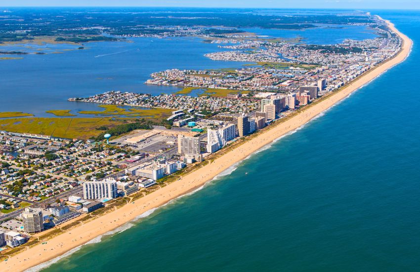
With 52 hours of nonstop drive, you will reach Ocean City in Maryland from West Sacramento, covering 3113 miles/5010 km. Traveling along US-50, this journey lives up to its name. Unlike the other coast-to-coast routes on our list, this one will lead you through empty roads with nothing around for hours. So if you plan to take it, ensure you’re fully packed with food, drinks, and emergency kits for everyone in the car and your vehicle. This lengthy road will need at least 52 hours to complete (with no stops and low traffic). There’s also a 43-hour alternative passing through I–94/I-90 covering 3045 miles/4900 km. And since West Sacramento isn’t a coast, pushing west to San Francisco will add another 85.4 miles/137 km to the distance coast to coast USA.

Route 50 will take you across Nevada, Utah, Colorado, Kansas, Missouri, Indiana, Ohio, West Virginia, and Maryland before you reach New Jersey. Here are some attractions you can add to your travel plan for an enjoyable drive along US-50:
- Eldorado National Forest
- Lake Tahoe
- Fort Churchill State Historic Park
- Cold Springs Station
- International Cafe & Bar
- Cave Lake State Park
- Lehman Caves
- Fort Deseret State Park
- Tamarisk Restaurant
- Moab Under Canvas
- Colorado National Monument
- Fort Uncompahgre
- Black Canyon of the Gunnison National Park
- Mountain Goat Lodge
- Royal Gorge Bridge and Park
- The Winery at Holy Cross Abbey
- PicketWire Canyonlands
- Garden City Inn
- Kansas Teachers Hall of Fame
- Kansas Underground Salt Museum (STRATACA)
- Clover Cliff Ranch Bed And Breakfast
- Fiorella’s Jack Stack Barbecue
- Missouri Town 1855
- Carlyle Lake
- Red Hills State Park
- George Rogers Clark National Historical Park
- Cincinnati Museum Center
- Holtfield Station
- Serpent Mound
- Tygart Lake State Park
- Cathedral State Park
- Sky Meadows State Park
- Clara Barton National Historic Site
- Lincoln Memorial
- US Naval Academy Museum
- Frontier Town, Western Theme Park
Remember, Route 50 is called “The Loneliest Road in America” for a reason. So unless you have the patience and enjoy being away from civilization for extended periods, taking other routes for your coast-to-coast trip might be a wise move.
You’ll Also Like
Best Cheap Summer Road Trips for College Students
Cheapest Places to Travel for Students
Best Places to Travel in December on a Budget
What’s the Cheapest Time to Fly to Morocco
The Southern Route
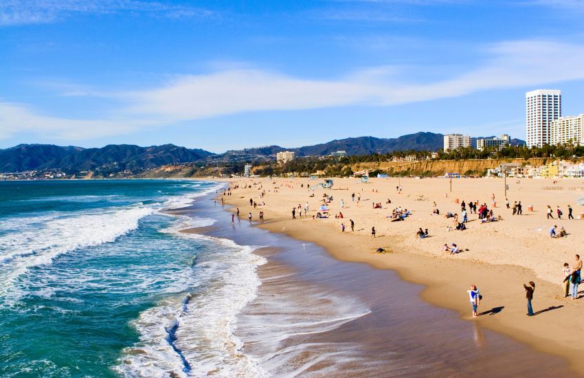
Traveling through Interstate 10, the Southern Route will need you to drive for 36 hours nonstop to cover 2430 miles/ 3911 km of distance coast to coast USA, from Santa Monica to Jacksonville. That’s a day and 11 hours and will wind through the states of Louisiana, Texas, New Mexico, and Arizona from Florida’s Jacksonville before you reach California’s Santa Monica.
If you plan to drive for 8 hours/day, it will need a little over four days to complete, while slowing down to 5 hours/day will need a week before you reach the west coast.

As always, cut your trip as needed and try to make it the best road trip possible! Here are some of the best stops you can take along the I-10 route. Pick ones that you think would best fit your personal preferences:
- Ichetucknee Springs State Park
- Railroad Square Art Park
- Tallahassee Automobile Museum
- Fairhope, Alabama
- Cafe du Monde
- Garden District
- Houmas House
- River Road
- Lake Charles
- Space Center Houston
- Six Flags Fiesta Texas
- Riverwalk at Alamo
- Balmorhea State Park
- Dark Sky
- White Sands National Park
- Saguaro National Park
- Heard Museum
- Joshua Tree National Park
- Disneyland
- Hollywood Sign
- Santa Monica Pier
The Southern Route via I-10 is ideal for traveling families with kids since there are plenty of themed parks and natural attractions throughout the journey. This road trip is best during summer when the sun is out, and everyone can enjoy the outdoors. Just remember to pack up lots of hydration! It’s pretty desert-y out here!
As your tires touch the final stretch of pavement, completing your road trip distance coast to coast USA, you’ll realize that this journey has been much more than just a physical distance traveled. It’s a testament to the true beauty of a road trip that lies not just in the destinations but in the moments and connections forged along the way.
You’ll have collected memories of sunsets that painted the desert in shades of gold, conversations with locals that opened windows into different ways of life, and snapshots of hidden gems that few have had the privilege to discover.
So, when the wanderlust tugs at your soul again, know that the road awaits. Gather your travel companions, pack your bags, and set out on another extraordinary journey. The road trip distance coast to coast USA may be an experience you’ll cherish forever, but it’s just the beginning of a lifelong love affair with exploration, discovery, and the boundless possibilities that lie ahead.
Planning a Road Trip?
Read our Guides
LA to Lake Tahoe Road Trip Guide and Itinerary
Road Trip to Utah from California
Texas to California Road Trip – 7 Day Itinerary
How Often Should You Let Your Car Rest on A Road Trip?
Is My Car Too Old for A Road Trip? A Checklist
San Francisco to Lake Tahoe 2-Day Road Trip
Sacramento to Lake Tahoe Road Trip Intinerary
San Fran to Monterey Bay Road Trip Guide
FAQs
What is the distance Coast to Coast in the USA?
It will depend on which route you take. It’s at least 2,800 miles and can go as long as 3100+ miles. Click here to learn more about Road Trip Distance Coast to Coast in USA.
Read more in our guide on Road Trip Distance Coast to Coast in USA.
How many miles from Coast to Coast?
Here’s a quick rundown of distance coast to coast USA:
– The Northern Route from Boston to Seattle via I-90: 3045 miles/4900 km
– The Middle-America Route from San Francisco to Teaneck via I-80: 2904 miles/4674 km
– The Panhandle Crossing from Barstow to North Carolina via I-40: 2411 miles/3880 km
– The Loneliest Road in America from West Sacramento to Ocean City via US-50: 3113 miles/5010 km
– The Southern Route from Santa Monica to Jacksonville via I-10: 2430 miles/ 3911 km
Read more in our guide on Road Trip Distance Coast to Coast in USA.
How long does it take to drive across the US?
– The Northern Route: 45 hours
– The Middle-America Route: 43 hours
– The Panhandle Crossing: 35 hours
– The Loneliest Road in America: 52 hours
– The Southern Route: 36 hours
Read more in our guide on Road Trip Distance Coast to Coast in USA.